Specialist data analysis of Highstreet Footfall, WiFi Demographics, Air Quality and Vehicle Counting across destinations such as public spaces, high streets, events, towns, cities and entertainment venues to deliver comprehensive insight into:
- visitor numbers
- dwell
- frequency
- demographics
- air pollution and
- traffic flow
Proximity Futures’ innovative approach to connectivity and the Internet of Things – IoT – enables the development and scaling of bespoke systems that provide both live and historical data that can be viewed, downloaded and interrogated.
Connected systems allow integration of a wide range of products; the more established WiFi and GEO-Sense products integrate with Air Quality and Vehicle Counting sensors and real-time environmental data collection sensors.
Our Data Solutions

Proximity Futures’ Elephant WiFi application has a heritage in building and installing robust high street networks that enhance the visitor experience while providing data analysis and visitor communication.

Proximity Future’s GEO-Sense system as a pedestrian footfall counting system providing anonymous insights on visitor behavior with no end user interaction required. It provides data on a wide range of metrics including unique visitor counts, frequency of visits and dwell time.

ENVIRO- Sense is Proximity Future’s is a more recent addition providing air pollution analysis of a wide range of environmental and atmospheric conditions in open spaces.

Similar to GEO-Sense, VEHICLE-Sense counts vehicles. Using a wide range of technologies such as ANPR, Object detection and more traditional systems TRAFFIC-Sense can be used for on or off road parking as well as vehicle classification on busy roads.
Decisions through data
Latest Posts & Reports
New Case Study Posted: Hereford City
Q4 2022 Footfall Report
New Case Study Posted: Newark and Sherwood
The ongoing dilemma….
Successfully providing solutions for
Case Studies
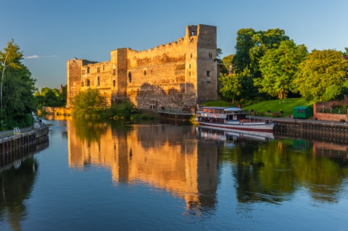
Newark and Sherwood: Using Geo-Sense to revitalise the Town Centre
Nestled amidst the rolling hills of Nottinghamshire, Newark-on-Trent is a charming market town steeped in history. From its majestic castle dating back to the 12th century to its bustling marketplace, Newark offers a unique blend of heritage and modern life. The town boasts a vibrant community of over 40,000 residents,…
Hereford City, UK: Transforming Data into Actionable Insight
Hereford City, located in the picturesque landscape of Herefordshire, UK, is utilising data to invigorate its city centre. This historic place, renowned for its medieval charm and iconic Hereford Cathedral, is filled with a blend of history and modern energy. Alongside its famed architectural landmarks, the city hosts a variety…